LAYERS OF EVIDENCE TO GARNER
SWAMPLAND INTELLIGENCE
baanytaageek: Great Swamp Regenerative Collective
LOCATION VIC Cardinia and Koo Wee Rup Boon Wurrung Country
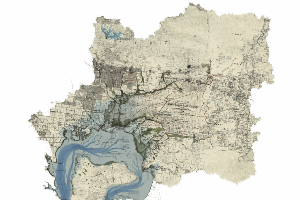
Understanding and working with the deep structure of environments requires a suite of forensic processes. Map-making can garner such intelligence through the careful piecing together of diverse knowledges over time and space. This layered map of the Great Swamp catchment on Melbourne’s eastern edge reveals its dynamic past and underlying waterscape in the context of radical colonial change.
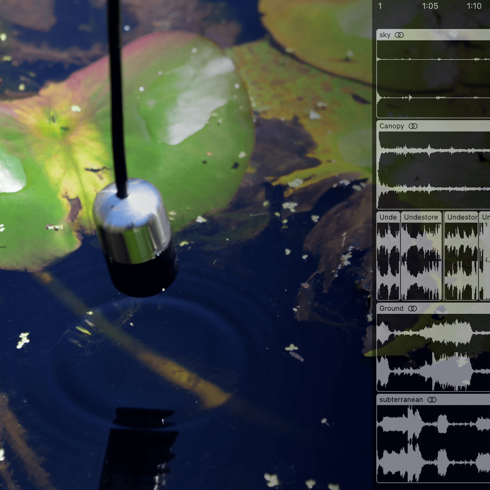
The map does not invent or project; it simply traces and records complexity, superimposing a version from one moment in time over another. This includes markings of explorers, records of subdivision and parish plans and the reconstruction of possible swamp zones, all shown in relation to topographic contours and geological features. The drawing, constructed using GIS technologies, includes archival material from a range of sources with different types of subjectivity overlaid and geo-positioned in relation to ‘official’ contemporary datasets. Further detective work includes recordings, which make ‘natural’ sounds audible by placing hand made microphones in mud on the ground, and enable deep time connection to the ‘material’ of place through the rhythmic patterns of Boonwurrung language.
AUTHORS: Nigel Bertram Catherine Murphy
CONTRIBUTORS N’arwee’t Carolyn Briggs Daniel Kotsimbos Rutger Pasman Ben Waters
IMAGE AUTHORSHIP Great Swamp Catchment drawing by Monash Urban Lab with Rutger Pasman, 2023.